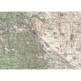
British Army’s Geographical Section – Geographical Section, General Staff, No. 4417, 1944 DESCRIERE


Harti istorice
Hărți istorice (reproduceri) sub forma de poster
-
British Army’s Geographical Section – Geographical Section, General Staff, No. 4417, 1944 DESCRIERE
150,00 Lei -
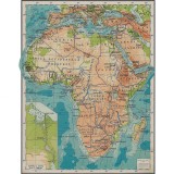
Harta fizica si politica Africa cu impartirea administrativa inainte de decolonizare, 1957 DESCRIERE
150,00 Lei -
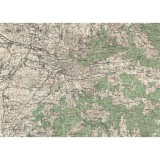
Harta administrativa RSR Republica Socialista Romania, 1978 DESCRIERE PRODUS Hartie: Greutate: 210
150,00 Lei -
Harta administrativa RSR Republica Socialista Romania, 1983 DESCRIERE PRODUS Hartie: Greutate: 210
150,00 Lei -
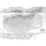
The Socialist Republic of Romania Economic Map, Made by V. Cucu and I. Petrescu-Burloiu,
150,00 Lei -
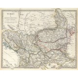
Turkey I, northern, Chapman and Hall, London, 1830 DESCRIERE PRODUS Hartie: Greutate: 210 gsm, pe
150,00 Lei -
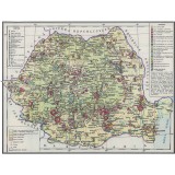
Harta administrativa RPR Republica Populara Romana Romania, 1964 DESCRIERE PRODUS Hartie: Greutate:
150,00 Lei -
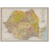
Harta economica RSR Republica Socialista Romania, 1983 DESCRIERE PRODUS Hartie: Greutate: 210 gsm,
150,00 Lei -
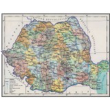
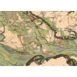
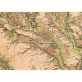
Carol Popp de Szathmari, Charta României Meridionale, 1864 DESCRIERE PRODUS Hartie: Greutate: 210
150,00 Lei -
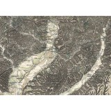
General Karte des Fürstenthums Walachei, K.K. Militärisch-Geographische Institut, 1867 DESCRIERE
150,00 Lei -
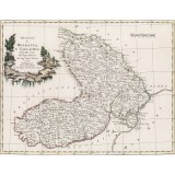
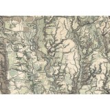
Principati di Moldavia, e Vallachia Tratti dalle Carte dell’Impero Ottomano, Rizzi Zanoni,
150,00 Lei -
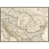
British Army’s Geographical Section – Geographical Section, General Staff, No. 4375, 1943 DESCRIERE
150,00 Lei -
British Army’s Geographical Section – Geographical Section, General Staff, No. 4417, 1943 DESCRIERE
150,00 Lei -
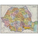
Carol Popp de Szathmari, Charta României Meridionale, 1864 DESCRIERE PRODUS Hartie: Greutate: 210
150,00 Lei -
Carol Popp de Szathmari, Charta României Meridionale, 1864 DESCRIERE PRODUS Hartie: Greutate: 210
150,00 Lei -
Carol Popp de Szathmari, Charta României Meridionale, 1864 DESCRIERE PRODUS Hartie: Greutate: 210
150,00 Lei -
Carol Popp de Szathmari, Charta României Meridionale, 1864 DESCRIERE PRODUS Hartie: Greutate: 210
150,00 Lei -
Carol Popp de Szathmari, Charta României Meridionale, 1864 DESCRIERE PRODUS Hartie: Greutate: 210
150,00 Lei -
Carol Popp de Szathmari, Charta României Meridionale, 1864 DESCRIERE PRODUS Hartie: Greutate: 210
150,00 Lei -
Carol Popp de Szathmari, Charta României Meridionale, 1864 DESCRIERE PRODUS Hartie: Greutate: 210
150,00 Lei